17
Oct
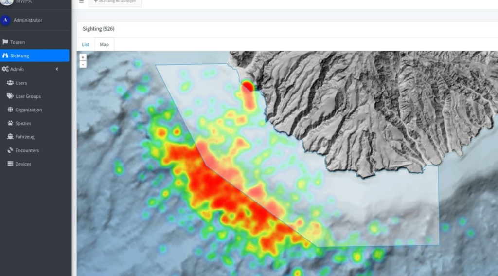
Updates on the Sightings Data App
About two years ago, in collaboration with the company Pegenau, we launched our digital sighting data app. Since then, it has been continuously developed by our software developer Stefan Werfling and our biologist Tina Sommer. We can now display multiple map layers simultaneously, such as a frequency map of marine mammals and the outlines of official marine protected areas. The next step will be to automate the start and end of sighting recordings using GPS data.
Information about the structure, development, and collaboration opportunities for the project can be found here: https://m-e-e-r-e-v.gitbook.io/mwpa